
Case study · Commercial
Telford Court
An office park in Chester, mapped from the air for a letting campaign. Site context, elevations and unit-by-unit reference in one flight.
Client
Managing agent
Location
Chester Business Park
Sector
Commercial
Delivered
72 hours
The brief
Three units were coming to market across a park the agent had never photographed as a whole. Tenants were being sent floor plans and a street-level photograph that told them nothing about parking, access or who else was on the site.
We flew the park in one session: a context set showing the estate in relation to the ring road, elevation passes on each available unit, and a set of orbit frames the agent could pull stills from for particulars. Ground-level interiors followed the week after fit-out finished.
Drone
Photography
Video
Site mapping
What we delivered
22
Aerial stills
Context, elevation and approach frames across the whole park.
01
Site-context map
Annotated overhead showing units, parking and access.
18
Interior stills
Reception, floor plates and shared amenity, post fit-out.
01
Aerial video
45-second orbit and reveal, cut for the letting brochure microsite.
Selected frames
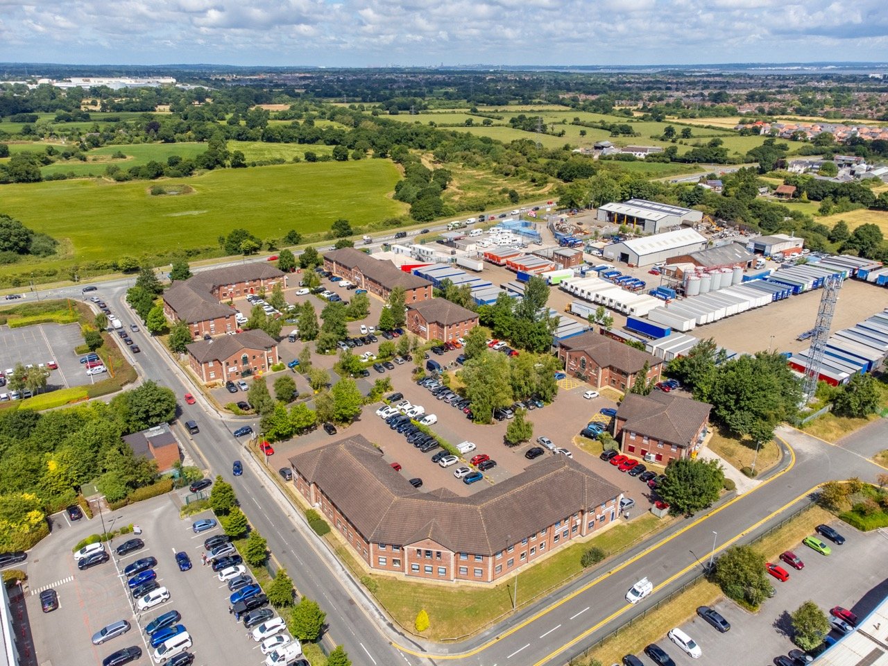
Context pass. The park read against the ring road and the wider business estate.
Unit C · elevation
Unit C elevation
Reception · interior
Reception, post fit-out
Approach · aerial
Parking and approach
Floor plate · interior
Floor plate, second storey
Aerial site map
The whole estate on one sheet.
An annotated overhead the agent sends with every enquiry. Available units picked out, parking ratios and access routes marked. Cheaper than a site visit and it answers the first three questions a tenant asks.
Placeholder — annotated site map
“Two of the three units let off the back of the aerial set. Tenants could see what they were walking into.”
Managing agent · Chester
On site
2 visits
Turnaround
72 hrs
Aerials
22
Interiors
18
Video
4K, 45s
Flight
A2 CofC